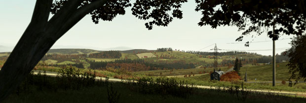
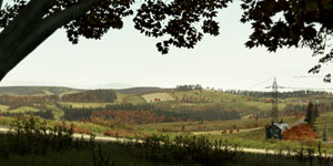
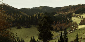
North-Eastern Chernarus is a hilly area with rocky coastlines; the biggest hilltops reach over 700 m above sea level, covered by temperate forests. The environment is still relatively untouched from logging and mining. The biggest cities and industry are concentrated on the southern coast. There are mostly smaller villages inland, situated in deep valleys, hidden in forested ridges or on elevated plateaus with lush meadows.
Shortly after WWII, the small Red Army airport in the Northern province, designated for parachute training, expanded and gradually evolved into an air base with large military surroundings. In the border mountains there are a few former bases. After the regaining of independence, the Chernarussian Army took over these military bases.
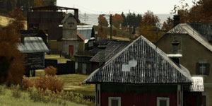
Despite the industrialization and the devastation of the coast, the Northern Province is proud of its untouched wild nature and idyllic agriculture countryside. Mostly because of the highland character of the North East part of the country, this was unsuitable for either industrial production or for collective agriculture.
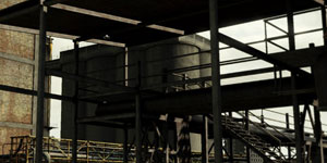
For the fast growing industrial production in the second half of the 20th century, the electricity inflow conducted by land from the west was insufficient; also the basic infrastructure of gravel roads was inconvenient. Yearly floods, created from the melting snow were constantly threatening the coastal railroad, built for the purpose of transporting cargo from Chernogorsk to the industrial centers. This was the only secure connection during the long-lasting rains.
The biggest city and the administrative center of the Chernarussian Northern Province is Chernogorsk. What was originally a small fisherman's village quickly grew into a city thanks to the intensive industrialization of the Chernarussian Autonomic Republic, which began in the 50's of the previous century. Chernogorsk has always been a harbor town, once connected to northern trade routes, now a place through which the raw materials flow to Elektrozavodsk.
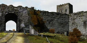
Chernarus has lots of old castle ruins, keeps and fortresses, which were built at the turn of the 11th and 12th century by Duke Kozlov, for the means of protecting important roads and grounds, which were often attacked from the sea and by northern neighbors. The Pik Kozlova above the Chernogorsk city is named after this duke, who is considered a founder of the first Chernarussian state. On the peak above the city there used to stand a warning post which protected the local provinces from pirate raids. This rocky peak is a favorite lookout point nowadays.